Region Definitions
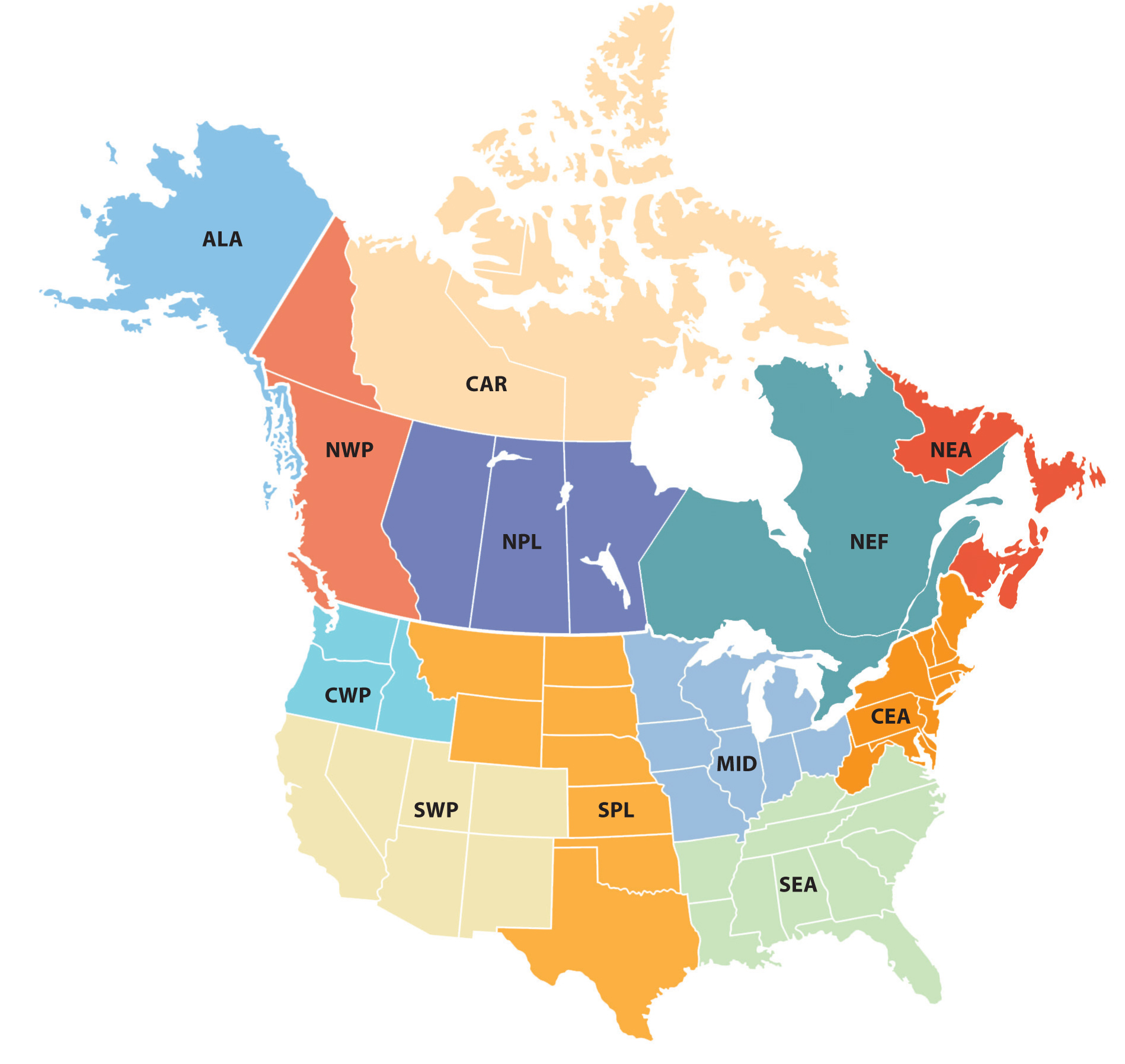
The map below shows the 12 regions used for the ACI; these regions are defined along state and provincial borders. Index values on this website are also available for the continental United States including Alaska (USA), Canada (CAN), and both countries combined (USC). Values for each region are based on grid level data, where each grid is 2.5 degrees latitude by 2.5 degrees longitude (within the land and coastal area of the United States and Canada from 25 to 75 degrees north latitude and 50 to 170 degrees west longitude).

ALA=Alaska
CAR=Central Arctic (NT, NU)
CEA=Central East Atlantic (CT, DC, DE, MA, MD, ME, NH, NJ, NY, PA, RI, VT, WV)
CWP=Central West Pacific (WA, OR, ID)
MID=Midwest (IA, IL, IN, MI, MN, MO, OH, WI)
NEA=Northeast Atlantic (NB, NS, NL, PE)
NEF=Northeast Forest (ON, QC)
NPL=Northern Plains (AB, MB, SK)
NWP=Northwest Pacific (BC, YT)
SEA=Southeast Atlantic (AL, AR, FL, GA, KY, LA, MS, NC, SC, TN, VA)
SPL=Southern Plains (KS, MT, ND, NE, OK, SD, TX, WY)
SWP=Southwest Pacific (AZ, CA, CO, NM, NV, UT)
